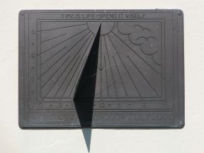
| Location | England East Sussex Iford |
| Village Hall | |
| Distance (S) from Greenwich | |
| OS map details | OS Explorer: 122 |
| OS grid ref | TQ 40764.07313 (540764,107313) |
| WGS84 lat/long | 50.848219, -0.001809 |
| Type | Sundial |
| Marking date | Jul 2001 |
| Access | Restricted, but visible from public road |
© 2009 – 2026 Graham Dolan
TheGreenwichMeridian.org database is owned by Graham Dolan. Except where indicated, all text and images
are the copyright of Graham Dolan.