The Greenwich Meridian
…where east meets west
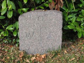
| Location | England Surrey Dormans Park |
| N side of: The Approach | |
| Distance (S) from Greenwich | |
| OS map details | OS Explorer: 146 |
| OS grid ref | TQ 39872.40604 (539872,140604) |
| WGS84 lat/long | 51.147615, -0.001659 |
| Type | Marker 'stone' |
| Marking date | 2000 |
| Access | Private road |