The Greenwich Meridian
…where east meets west
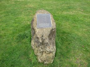
| Location | England Lincolnshire Winceby |
| footpath (Snipe Dales) | |
| Distance (N) from Greenwich | |
| OS map details | OS Explorer: 273 |
| OS grid ref | TF 33588.68720 (533588,368720) |
| WGS84 lat/long | 53.198784, -0.001634 |
| Type | Boulder |
| Marking date | 1999 |
| Access | Restricted (park opening hours) |